Start-up Fleet Space, which has a presence in Australia, Chile, Canada, Luxembourg, and the United States, hit the headlines in November 2025 by using its satellite-powered AI system to expand the scope of an already-discovered massive lithium deposit in Canada’s Quebec.
Commercial mining is not everyone’s cup of tea. Only about three in 1,000 potential deposits end up becoming commercially viable, and even then, it takes years to prove it by drilling core samples. As per Fleet Space, its tech-powered approach can help target drilling operations, reducing decision time from weeks to days.
Fleet Space set up its own constellation of satellites in orbit that use a range of sensors, including electromagnetic and gravity-sensing, to map the subsurface. The start-up feeds that data into its software platform, which can provide a new location for drilling in as little as 48 hours.
The ongoing “Cisco Project” in Quebec believes that it could produce up to 329 million metric tons of lithium oxide in the coming days, with Fleet Space even claiming that the initiative’s results might extend beyond Cisco’s current boundaries, as the start-up predicts the region having “district-scale potential.”
Using Technology To Solve Global Challenges
Established in 2013, Fleet Space is pushing the boundaries of innovation with breakthrough advances in space technology, multiphysics data acquisition, edge computing, and AI.
Exploration today is a data problem. Decades of valuable datasets are trapped in silos or incompatible formats. Fleet Space’s integrated geoscience platform is turning this complexity into clarity by combining historical data and new satellite-enabled geophysics into a single, interoperable source of truth.
The venture is fusing cutting-edge geoscience data into one seamless space-based platform, delivering faster target generation, standardisation of multi-source data, deeper insights, and greater confidence across every stage of mineral exploration, addressing concerns like shortening the time to target and optimising exploration budgets in capital-constrained environments. The solution, named “ExoSphere by Fleet,” is turning mining prospects into drill-ready targets faster, with more precision and reduced uncertainty.
And it has positively disrupted the industry, given the fact that legacy consultants and AI vendors operating in the sector have their own issues: neither their data acquisition is comprehensive, nor can they prove the accuracy of the information. Even the foundational model used by them is a generic one (often a third-party tool or partner product).
Even the surface-level models are off-the-shelf ML libraries trained on limited, non-contextual datasets. Thanks to Fleet Space, its industry partners are now having real-time data acquisition, possessing full ownership and control over new data quality, speed, and frequency, thereby enabling real-time geophysical insights.
“ExoSphere by Fleet” is a unified exploration platform that combines sensing, processing, modelling and artificial intelligence (AI), designed from the ground up into one coherent system. It integrates a growing suite of advanced geophysical methods, each delivering faster, cost-effective and environmentally responsible exploration outcomes. It adapts across scales, from broad district assessments to high-resolution target definition.
Unified Exploration Intelligence
ExoSphere is the first end-to-end solution integrating space-enabled geoscience, real-time data acquisition with on-the-field quality control (QC), and predictive AI drill targeting. It transforms disconnected datasets into decision-ready intelligence, delivering speed, confidence, and clarity across the exploration lifecycle. By fusing geophysics, geochemistry, historical drilling, and AI into a cohesive decision-making system, Fleet Space enables rapid iteration and faster paths to geological insight.
ExoSphere’s lightweight, passive, and low-disturbance tools reduce the need for invasive equipment. This becomes particularly valuable in sensitive ecosystems, remote terrains, or regions where land access must be negotiated or permits are required. In these contexts, speed and a minimal footprint become strategic advantages.
By fusing cutting-edge geophysics, geochemistry, drill results, and AI into a cohesive decision-making system, ExoSphere is reducing delays, increasing resolution, and moving from survey to drill-ready target faster than ever before.
ExoSphere ensures consistent, high-quality data across exploration stages and campaigns. From initial surveys to drill programme integration, all inputs get calibrated, validated, and fed into a single evolving model. This continuity removes data silos, reduces rework, and preserves the integrity of insights over time, the source of truth for decision-ready data.
The ExoSphere Suite
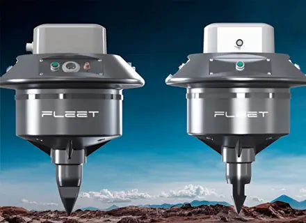
ExoSphere consists of first-of-its-kind wireless Geodes that combine intelligent cloud processing and a network of Low Earth Orbit (LEO) satellites. The innovation captures data in real-time and accelerates geophysical data acquisition at a neck-breaking speed.
These advanced sensors also deliver rapid, non-invasive subsurface insights, enabling exploration teams to identify critical resources up to 100 times faster than traditional methods while reducing environmental impact and improving operational efficiency. The solution fuses multiple geophysical methods into a single, standardised 3D subsurface model—clean, real-time, and ready to act on.
AI-driven tool ranks and scores drill targets by integrating geophysics, geochemistry and drill data, removing human bias. Technology combines geophysical and geochemical models with drill data to deliver high-confidence exploration targets; ranked, scored, and ready for action.
ExoSphere’s “Platform” is a connected web portal that combines AI, geophysics, and collaboration to turn exploration data into decisions, fast. It delivers transformative real-time connectivity, allowing users to seamlessly upload, process, and interpret geological and geophysical datasets. By combining AI-assisted tools, predictive modelling, and a collaborative workspace, ExoSphere turns raw data into actionable insights, accelerating informed decision-making.
The Maaden Case Study
Fleet Space works with some of the most complex and ambitious mining portfolios on Earth. Take Maaden (Saudi Arabian Mining Company), for example, which, through the start-up’s assistance, is accelerating its mineral strategy with data-led exploration to match the scale of the USD 2.5 trillion opportunity in the Arabian Shield.
Fleet Space’s next-generation geophysical sensors, which capture natural seismic signals across wide terrain, are helping Maaden to enable wide-area coverage with minimal environmental impact. Satellite connectivity and space telemetry are transmitting data from remote sites in real-time, removing lag and logistics associated with traditional data collection.
The start-up’s “AI Processing Engine,” which builds 3D models of subsurface structures within hours, is providing Maaden with predictive, more accurate, scalable drill targeting insights. The “Edge Processing and QC,” known for validating and filtering data quality in the field before transmission, is ensuring only clean, usable data reaches Maaden’s processing activities. Also, “Digital Data Repository,” by storing, reprocessing and integrating datasets across tenements, is creating long-term exploration intelligence and continuity.
Photo Credits: Fleet Space